
-
This drawing is neither a legally recorded map or a survey and is not intended to be used as such. The information displayed is a compilation of records, information and data obtained from various sources, including the Park City School District, which is not responsible for its accuracy or timeliness.
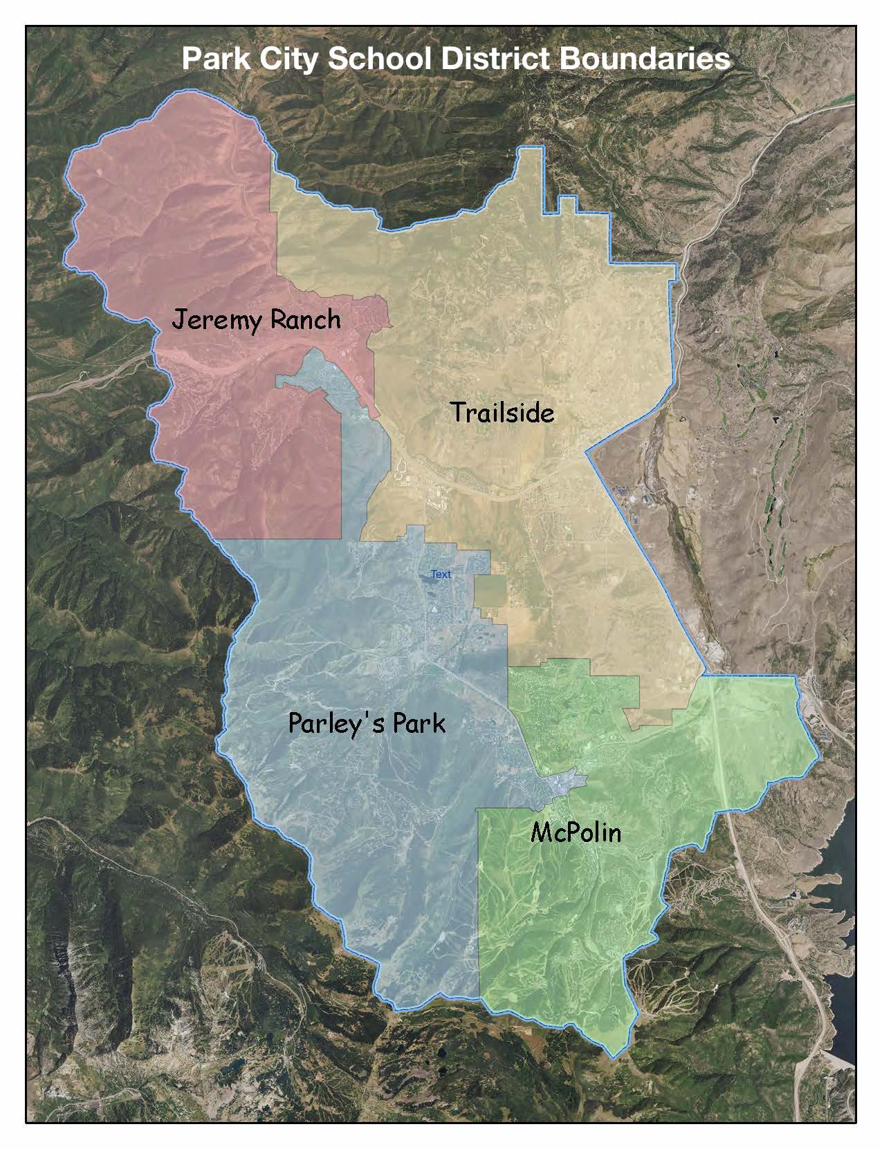
Jeremy Ranch Elementary School
Neighborhoods include: Jeremy Ranch, Hidden Cove, Summit Park, Timberline, Upper Pinebrook, Elk Meadows, Southridge, The Trails at Jeremy Ranch, and NW of Red Hawk Trail and Red Hawk Court.McPolin Elementary School
Neighborhoods include: Deer Valley, The Aerie, Solamere, McCleod Creek, Park Meadows, Prospector, Kearns Boulevard east of Bonanza/Monitor intersection, Old Town and Ridge View.Parley’s Park Elementary School
Neighborhoods include: Ironhorse, Aspen Springs, Albertson’s (Kearns Boulevard west of Bonanza/Monitor intersection), Iron Canyon, Snow Country, Thaynes Canyon, The Colony at White Pine Canyon, The Canyons Resort area, Northshore, Southshore, Sun Peak, Silver Springs, Bear Hollow, Park West Village, Ranch Place, part of Old Ranch Road (from SR 224 to 901 Old Ranch Road), Snyder’s Mill, Brook Hollow, Cottages, Cedar Ridge, Eagle Ridge, Elk Run, High Meadows, Horse Thief, Pinebrook Point, Quarry Junction and Ranch Condos.Trailside Elementary School
Neighborhoods include: Powderwood, Kimball Junction, Spring Creek, Black Hawk, Silver Creek*, Canyon Creek, Bitner Road, Goshawk Ranch, Redstone, Silver Summit, Highland Estates, Park Ridge Estates, and part of Old Ranch Road. For specific address information please call the transportation department. *Silver Creek Village is not within the boundaries of Park City School District, and instead falls within South Summit School District.